Checked
Oakville parks directory
Oakville, Ontario, Canada
Find Oakville, Ontario parks and open spaces, with individual descriptions, recorded facilities, photos where verified and Google Maps.
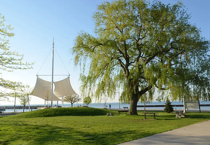
Key information
Browse 566 park and open-space sections for Oakville. Search a name, street or recorded feature, then open that place’s map. The source scope and any missing information are explained below.
On this page
What this directory covers
| Detail | Coverage |
|---|---|
| Individual sections | 566 |
| Source scope | All 566 polygons in the Oakville Parks feature layer used by the official town information map. Includes named parks, valleys, woodlots, community links, buffer blocks, schoolboard land and undeveloped parkland. Each original parcel and ID is preserved. |
| Coverage limits | All entries in the stated source scope are included. This does not establish current public access. |
All 566 polygons in the Oakville Parks feature layer used by the official town information map. Includes named parks, valleys, woodlots, community links, buffer blocks, schoolboard land and undeveloped parkland. Each original parcel and ID is preserved.
Recorded facilities can be seasonal, closed or out of service. A blank field means not confirmed. A map point may mark park land rather than a public or accessible entrance.
Sources: Oakville official parks inventory · Oakville park visitor information
Find a park
Search the recorded names, streets, descriptions and facilities. Each result has its own section and map links. Only the places on the current page are downloaded.
Some pins mark park land rather than an entrance. Official park pages have current visiting details.
421 to 440 of 566 places
Reynolds Community Park
345 Reynolds Street
Reynolds Community Park is recorded as community park in Ward 3. The inventory records 0.604 hectares for this parcel.
- Land classification
- Community Park
- Ward
- Ward 3
- Recorded area
- 0.604 hectares
Sources: Oakville official parks inventory
Ridgeview Park
156 Sewell Drive
Ridgeview Park is recorded as neighbourhood park in Ward 5. The inventory records 0.905 hectares for this parcel.
- Land classification
- Neighbourhood Park
- Ward
- Ward 5
- Recorded area
- 0.905 hectares
Sources: Oakville official parks inventory
Rimmington Park
316 Rimmington Drive
Rimmington Park is recorded as neighbourhood park in Ward 5. The inventory records 0.232 hectares for this parcel.
- Land classification
- Neighbourhood Park
- Ward
- Ward 5
- Recorded area
- 0.232 hectares
Sources: Oakville official parks inventory
River Glen Park
367 River Glen Boulevard
River Glen Park is recorded as neighbourhood park in Ward 5. The inventory records 3.053 hectares for this parcel.
- Land classification
- Neighbourhood Park
- Ward
- Ward 5
- Recorded area
- 3.053 hectares
Sources: Oakville official parks inventory
River Oaks Community Centre
2400 Sixth Line
River Oaks Community Centre is recorded as community park in Ward 5. The inventory records 2.593 hectares for this parcel.
- Land classification
- Community Park
- Ward
- Ward 5
- Recorded area
- 2.593 hectares
Sources: Oakville official parks inventory
River Oaks Park
2400 Sixth Line
River Oaks Park is recorded as community park in Ward 5. The inventory records 6.115 hectares for this parcel.
- Land classification
- Community Park
- Ward
- Ward 5
- Recorded area
- 6.115 hectares
Sources: Oakville official parks inventory
River Oaks Public School
2173 Munn's Avenue
River Oaks Public School is recorded as schoolboard in Ward 5. The inventory records 1.619 hectares for this parcel.
- Land classification
- Schoolboard
- Ward
- Ward 5
- Recorded area
- 1.619 hectares
Sources: Oakville official parks inventory
Riverbank Park
1072 Riverbank Way
Riverbank Park is recorded as neighbourhood park in Ward 5. The inventory records 0.066 hectares for this parcel.
- Land classification
- Neighbourhood Park
- Ward
- Ward 5
- Recorded area
- 0.066 hectares
Sources: Oakville official parks inventory
Riverbank Pond
10 Lions Valley Park Road
Riverbank Pond is recorded as minor valley in Ward 5. The inventory records 1.354 hectares for this parcel.
- Land classification
- Minor Valley
- Ward
- Ward 5
- Recorded area
- 1.354 hectares
Sources: Oakville official parks inventory
Riverstone Park
2273 Trafalgar Road
Riverstone Park is recorded as neighbourhood park in Ward 6. The inventory records 0.652 hectares for this parcel.
- Land classification
- Neighbourhood Park
- Ward
- Ward 6
- Recorded area
- 0.652 hectares
Sources: Oakville official parks inventory
Riverview Park
3007 Lakeshore Road W.
Riverview Park is recorded as major valley in Ward 1. The inventory records 11.147 hectares for this parcel.
- Land classification
- Major Valley
- Ward
- Ward 1
- Recorded area
- 11.147 hectares
Sources: Oakville official parks inventory
Robvale Park
Street address not supplied by the source
Robvale Park is recorded as neighbourhood park in Ward 7. The inventory records 4.12 hectares for this parcel.
- Land classification
- Neighbourhood Park
- Ward
- Ward 7
- Recorded area
- 4.12 hectares
Sources: Oakville official parks inventory
Rochester Pond
2150 Rochester Circle
Rochester Pond is recorded as minor valley in Ward 1. The inventory records 0.804 hectares for this parcel.
- Land classification
- Minor Valley
- Ward
- Ward 1
- Recorded area
- 0.804 hectares
Sources: Oakville official parks inventory
Rock Point Pond
2313 Rock Point Drive
Rock Point Pond is recorded as minor valley in Ward 6. The inventory records 0.288 hectares for this parcel.
- Land classification
- Minor Valley
- Ward
- Ward 6
- Recorded area
- 0.288 hectares
Sources: Oakville official parks inventory
Runnymead Park
1030 Nottinghill Gate
Runnymead Park is recorded as neighbourhood park in Ward 2. The inventory records 0.204 hectares for this parcel.
- Land classification
- Neighbourhood Park
- Ward
- Ward 2
- Recorded area
- 0.204 hectares
Sources: Oakville official parks inventory
Samuel Curtis Parkette
3575 Lakeshore Road W.
Samuel Curtis Parkette is recorded as neighbourhood park in Ward 1. The inventory records 0.137 hectares for this parcel.
- Land classification
- Neighbourhood Park
- Ward
- Ward 1
- Recorded area
- 0.137 hectares
Sources: Oakville official parks inventory
Sandy Lane Parkette
3193 Sandy Lane
Sandy Lane Parkette is recorded as neighbourhood park in Ward 1. The inventory records 0.044 hectares for this parcel.
- Land classification
- Neighbourhood Park
- Ward
- Ward 1
- Recorded area
- 0.044 hectares
Sources: Oakville official parks inventory
Saw Whet Park
2360 Saw Whet Boulevard
Saw Whet Park is recorded as neighbourhood park in Ward 4. The inventory records 2.125 hectares for this parcel.
- Land classification
- Neighbourhood Park
- Ward
- Ward 4
- Recorded area
- 2.125 hectares
Sources: Oakville official parks inventory
Saw Whet Pond
2292 Saw Whet Boulevard
Saw Whet Pond is recorded as minor valley in Ward 4. The inventory records 2.012 hectares for this parcel.
- Land classification
- Minor Valley
- Ward
- Ward 4
- Recorded area
- 2.012 hectares
Sources: Oakville official parks inventory
Seabrook Park
2069 Seabrook Drive
Seabrook Park is recorded as neighbourhood park in Ward 1. The inventory records 2.078 hectares for this parcel.
- Land classification
- Neighbourhood Park
- Ward
- Ward 1
- Recorded area
- 2.078 hectares
Sources: Oakville official parks inventory
Planning your park visit
Why does this list include woodlots and valleys?
The town’s parks layer includes these land classes, not only landscaped neighbourhood parks. Each record shows its classification.
Can I bring a personal barbecue?
No. The town’s parks by-law summary prohibits personal barbecues and fires.
Do I need a permit for a large picnic?
Yes. A picnic with 25 or more people requires a permit, and picnics must take place in designated areas.
Can I camp in a town park?
Only with written permission from the Director. Ordinary park access does not include camping.
How long can my dog’s leash be?
Cats and dogs must be leashed with a leash no longer than two metres. Dogs may be off leash only in a fenced, designated leash-free area.
Can my team practise without a permit?
Team games and practices require permits. Sports should take place in the purpose-built fields and facilities provided by the town.
Who switches off sports-field lights after a booking?
The permit holder must turn off the lights at the end of the game or practice when the permit allows their use.
Does the parks by-law cover trails and harbour land?
Yes. It covers town-managed parks, gardens, trails, valleys, squares, athletic fields, harbour lands and recreation grounds.
Does each map identify the entrance?
No. Polygon centres identify land parcels. Where the inventory supplies a street address, it is shown, but an accessible visitor entrance has not been verified.
Does a missing address mean the park is closed?
No. It means the GIS source did not supply a street address. Access and operating conditions must be confirmed separately.
Official park information
Sources: Oakville official parks inventory · Oakville park visitor information